Thursday, 31 July 2014

View of the the left side?

View of the the left side?

Do we need to see the tattoo I've just burned into my left side? Maybe after it's a bit healed and not red about the edges.  Or maybe right now with the red about the edges.  


Breath in breath out   dead calm.   


O by the Icelandic gods, I could use it.

This is Ólafía Kristjánsdóttir, the artist at Reyjavík Ink.
O by the Icelandic gods, I could.


Hitchhikers

Hitchhikers

There was never a hitchhiker that didn't get a ride from me while I was driving in Iceland.  I remember hitching all over Portugal, northern Spain on to Paris, my EuroRail pass forgotten (for the meantime) some 30 years ago, while I was backpacking all of Europe, and I remember that first brave go at it, outside Lisbon, Portugal, and getting pickt up in minutes, and however easy or however hard to get a ride, it was always a great way to travel.

I remember that feeling when the car or truck slowed down....I was going to pass that on, not pass on.

I must've pickt up say 20 or so, usually two, one time three, one time one.  You had to be out very early in the morning or late in the afternoon to get lucky.  (This sounds so Sweeney Todd.)  
At the drop off, I'd've forgotten their names already, but we were all best friends forever.   American, French, Swiss German, Swiss French, German, Dutch, Italian, Czech...  One Czech couple told me that they knew me, because I'd given two of their Czech friends a ride the day before.  And they knew the only three words in Czech* I admitted remembering!  (I studied it, with limited success, just school Czech.)  The Swiss women I pickt up, I insisted they tell me a story while I drove, like that was a part of the bargain.  One free ride = one story.  It was so interesting that I wish I'd played that off from the start.

Anyway, about the one time three.  I pickt up Lucas, from Berlin, parents German and Chilean.  Going to Skógar.  He had two other friends behind him with not as much success as he's having.  The three were meeting in Skógar to hike the Fimmvörðuháls trail north over the pass, into Þórsmörk and continuing on the Laugarvegur trail to Landmannalaugar, about four or five days.  I'm going into this detail, because this hike is the most popular and beautiful hike in Iceland.  I was planning on hiking the Fimmvörðuháls trail myself.  Actually, the next morning. 

I could give him a ride only as far as Seljavallalaug geothermal pool, and Skógar was not too far another hitch.  I needed to eat something, and then I was already planning to go to the outdoor pool.  He decided that he and his two friends would meet there instead, and enjoy the same hot swimming pool too.  I could give them all a ride further along to Skógar afterwards.

I meet Antton and Luigi there later, and after the swim, I drop them off at the Skógar camp, with the beautiful and famous seen-on-many-auto-commercials Skógarfoss waterfall.  They're planning on taking off while there's still light enough to hike, which is until about 23:00 or so.

You've read the Fimmvörðuháls post, so I'll skip to the part of it where we find the camping hut at the top of the pass.  There I meet up with Lucas, Antton and Luigi again!  Surprised, because they had such a head start on us.  Then not surprised when I saw how much gear they had on their backs.  And it was that rain and sleet hike too.  We parted ways again, caught up, and parted ways again, and then I lost them...

Years later I'm in Reykjavík. I'm back from all my geology treks along South Iceland, and I walk out of a kaffihús and there's Lucas, Antton and Luigi, back safe from their Laugavegurinn hike. Nice to see them again! Three times a charm.
  
Luigi, Benjamin, Antton, Lucas
?, American, Finn, German
(I think that's right.)
I never ran into any of my other friends-forever hitchhikers though, as I did with these three crazy guys.  

P.S.  Antton and I shared our online blogs, and he gave me a slip of paper with "souvvi" written on it, a collaborative blog he and friends have put together.  Lots of photographs, adventures, and reasons to still keep yourself as young as I try to, however old my passport claims.

-------

*My three Czech words:
Dobrýtro Morning
Až ti slůně sluníčko   When the baby elephant sun
šlapne ráno na vičko,   is stepping on your eyelids in the morning,
neplač,   don't cry,
vždyt’ to nebolí,   afterall, it doesn't hurt,
a běž honem do školy!   Hurry and go to school!

Fjögur píanó

Fjögur píanó

Twilight over Skeiðarárjökull, a glacier on Vatnajökull icecap of Iceland.  This is a video I took 31 July 2014, at 00:30.  Yes, in the morning.  I'm facing due north.  Fjögur píanó is playing on the car stereo and matcht the quietness fairly well.
Watching this at 12:30 AM may help lull you to sleep.  Not the intent, but not a drawback.  The slow up and down of the horizon, my steady breathing holding the camera...my anda inn anda frá...


Wednesday, 30 July 2014

Svínafellsjökull ice climbing

Svínafellsjökull ice climbing


I started out breaking in my new hiking boots on a treadmill at the Wellness Center back in February 2014, and put myself on a pretty rigorous 6km in an hour on a 5 to 10‰ incline.  I planned on a lot of hiking for three weeks and I wasn't going to be near dead at the end of the trip.  I was hiking an hour four or five days a week.

One of the excursions I planned on was hiking on a glacier.  I'd never seen one, I wanted to see crevasses, blue ice, moraines, kettle lakes, hear grinding and cracking as the glacier moved....  A part of one hike however was ice climbing, which lookt so cool, but having a paralyzing fear of heights, it wasn't going to happen.

But the Wellness Center has a 15 meter climbing wall that I had to pass by every day, and I thought, I can do this.  I'm fifty-three.  I took the class in top climbing, it took me six weeks to get to the top of the wall without a panic attack.  I made good progress if not slowly.  I was ready for Ice Climbing.  I was over my fear of heights.  

Ice climbing isn't quite the same as top climbing, but you are belayed, and the carabiners at the top of the climb are attacht to long screws bored into the ice. But the method for getting up there is the axes you use to create a new hold, and crampons bound to your boots for you to kick their spikes into the ice creating a new hold.  It's best just to see it in pictures. 

This is our guide Jonni preparing the gear.  A lot of what he did I recognized and was glad of it actually.  We were taught to look over each person's ropes and knots and have everything in order before starting.  That I recognized what he was doing was reassuring to say the least. 

Jonni, our guide, preparing the ice screw bolt, to attach the belay carabiners.


I had one of the men in our group take lots of pictures of me as I climbed up a crevasse wall in the glacier Svínafellsjökull.  You need to scroll down to the bottom of this page and work back up to properly follow the climb!  I wish I'd askt how high the wall was.  Maybe 10m?  It's less than the climbing wall I'd learned the sport on.   


Success!


Properly tying in and checking everything.


START HERE &
SCROLL UP


A half hour before this the sky was blue and sunny and suddenly gray covered the entire glacier, making for not as beautiful pictures, but it didn't distract from the fun.  By the way, my polarized sunglasses made the entire glacier classic ice blue.  Amazing color. 

This glacier in important respects is not an ordinary one.  Note the precipitous wall of ice pouring of the Vatnajökull icecap in the distance of both photographs.  These are to Creative Commons photographs of the glacier and both have a perfect view of that wall.  It's an ice fall.  The glacier tumbles down this slope at 2 meters a day as huge blocks of ice.   We would come no closer than these pictures as that part of the glacier is extremely hazardous.  Also, the crevasses you see in the first photo all have streams and the suddenly disappear into deep holes making glacier hiking a dangerous sport and we'd be hiking on the tops of these clefts only where safe and properly belayed or our harnesses attacht to rope lines bolted along the tops.  It was on a crevasse wall that we did our ice climbing.  Naturally, that part of the glacier is constantly monitored for the safety of both hikers and climbers.


http://www.23hq.com/deviaxe/photo/5985448
deviaxe/23
The Svínafellsjökull ice fall
Note, the the map, west of Tindaborg, how
the contour lines show the ice fall very clearly.

http://nl.wikipedia.org/wiki/Gebruiker:Bromr; http://commons.wikimedia.org/wiki/File:Sv%C3%ADnafellsj%C3%B6kull.JPG
Bromr/wikicommons

Jökulsárlón

Jökulsárlón

Jökulsárlón is easily Iceland's purest gem. I do not exaggerate and I mean that quite literally. It is a vast lake at the tongue of the Breiðamerkurjökull glacier flowing out of the Vatnajökull icecap. Before 1900 the glacier had advanced to within 1 km of the ocean. In its steady retreat since the 1930s, now about 6 km from the sea, it formed a vast glacial lake, now the deepest in Iceland. What makes the Jökulsárlón lake so photogenic is the number of icebergs that calve off the glacier. Ancient glacial ice is a luminous blue, as all the air in the ice has been squeezed out of it. These blue gems floating in the lake take years to finally exit the lake and find themselves floating away from shore, though some are beacht on the shoreline and it's simply fascinating, to see and touch ice-age blue ice, and the experience is well, insert word here that you think probably works for you... I don't know. Bored comes to mind. Wow, that's flippant. Sigh. That loss for words.
 
Blue icebergs float out to sea, some are beacht on
shore and continue to melt and shaped by the waves.

Glacial ice


http://commons.wikimedia.org/wiki/File:49_laguna_Jokulsarlon_%286%29.JPG
Ljuba Brank/wikicommons
In the distance, Breiðamerkurjökull calves
blue icebergs into Jökulsárlón


Benjamin, you are never at a loss for words.


I spent well over an hour taking video of the ocean waves, as I've written before, I always do.  This time I have waves are crashing over boulders of ice blue.  The full sunlight on the ice makes for what?  I don't know. Footage.

Note to self: to visit Breiðárlón lake, as Jón had advised, though maybe it's a bit off the well worn track, hidden up in the mountain, it's a lake off the same glacier, is, as I understand it, marvelously more boring if that's naturally possible. Do not not go your next visit in Iceland.


Tuesday, 29 July 2014

Ingólfshöfði, Höfn og Lónsöræfi

Ingólfshöfði, Höfn og Lónsöræfi

I'd moved on to the Southeast coast of Iceland now, in order to visit several places along that coast, a thin strip of land between the vast Vatnajökull icecap and the sea, to be closer to several destinations that needed visiting.

Adventures from Ingólfshöfði northeast to Lónsöræfi

Ingólfshöfði is the cape on this southeast coast, a proper west end of that stretch of Iceland. There's no reason other than this to visit: I'm related to the Viking having landed there in Iceland in or around 871. Ingólfr used pagan magic to find what would be his permanent homestead in 874, which he named "Bay of Smokes", or "Reykjavík", after all the geothermal steam rising out of the earth. He's considered the first permanent Norse settler of Iceland, as that was his intent (unlike others who were explorers and stayed only temporarily). That cape is named after him, Ingólfshöfði, literally Cape Ingólfs.


I'm related in a very twisted impossible long branched back on itself but complicated and quite imaginative genealogy but I can write out my proper Icelandic patronymic as Benjamín Ingellsson, and with a light reworking the name into a proper/closest Icelandic spelling, it's Benjamín Ingólfsson. I can speak fluent Icelandic in my sleep with no detectable accent.

The main attraction of the headlands there is the huge colonies of birds on the cliffs, primarily puffins. I can say there were no puffins to be found on the cape headland that day. The sun wasn't out, it was calm and though cloudy, just overcast. Puffins like to fly and fish when it's windy and rainy. We saw enough birds to count on two hands or two person's two hands. The others on the trip were sorely disappointed, having only a few skua assault them with obscenities. Puffins are cute and colorful, but in all seriousness, I was looking for puffin on the menu somewhere (and was never successful with that, by the way).

These photographs of the sandur with this sheen of water mirroring the sky, I have dozens of photographs, each is so incredible to me, as there is no horizon, especially if I properly crop them.
The sandur we cross to Ingólfshöfði is a near perfect mirror.


It's impossible to get to the cape headland except by hay tractor and that must trek across several kilometers of sandur with the slightest sheen of water covering the black sand. I had visions that there must be quicksand pits somewhere in the vastness. Wish I'd askt. The basalt headland is a cliff rising vertically from the sea, but the lee side is a sand dune slope that we could hike up to the top of, green with grass, with a lighthouse and rescue hut. The cliff is classic basalt columns and some twisted about and curiously turned so that in some places, the cleavages seemed to be tiles on the face of the cliff. The sand is jet black and lots of flotsam and jetsam from fishing boats, both local and Gulf coast.


Three puffins hunting
I helpt our guide Matthildur with some geology points she could rely on (as some tourists could be difficult it seems), and she presented me with a few pumice stones from her farm nearby, which was really appreciated. Takk!!  

Ingólfshöfði from Hofsnes

Ingólfur took the land now called Ingólfshöfði and Benjamín took black basalt sand at Ingólfshöfði.


Ingólfur tók þar land er nú heitir Ingólfshöfði.  Landnámabók
---

It's early dinner for me when I arrive in Höfn and I'm at the Pakkhús for their well-known special, the langoustine (a kind of lobster). Höfn is famous for it, and have a yearly festival to celebrate their being famous for it. It was an excellent meal, lots of good meat and butter sauce and plenty of bread to soak that all up.


Outside my window I could just see a bit of the fishing boat, the Sigurður Ólafsson, that brought the haul in.  Perhaps that day.  The beer was the locally popular (if only among tourists) Vatnajökull, brewed from trillion year old Vatnajökull icecap meltwater and the thyme that grows on the slopes of the mountains.  I forgot the exact age of the water actually.  But make no mistake, the meal was excellent and the restaurant staff sweet.  I promised myself to come back after a walk.

---

I drive northeast, through a tunnel and over the very very wide Jökulsá í Lóni river plain to find Stafafell, its guesthouse and the beginning of what is truly a very beautiful hiking trail. It's still fairly cloudless, the sun is low but not so low; I have several hours before proper sunset. So I intend to take on the 14km trail up into the highlands above the Jökulsá, then down a valley at Krossgil and back on the road running along the east bank of the river and back to the guesthouse. The orange trail on this map. I wasn't too concerned about making the length of the trail to its furthest northwest point, I'd plenty of light to do that. If it got too dark by then, well, I'd be hiking back on the gravel road running alongside the Jökulsá in nothing worst than dusk.


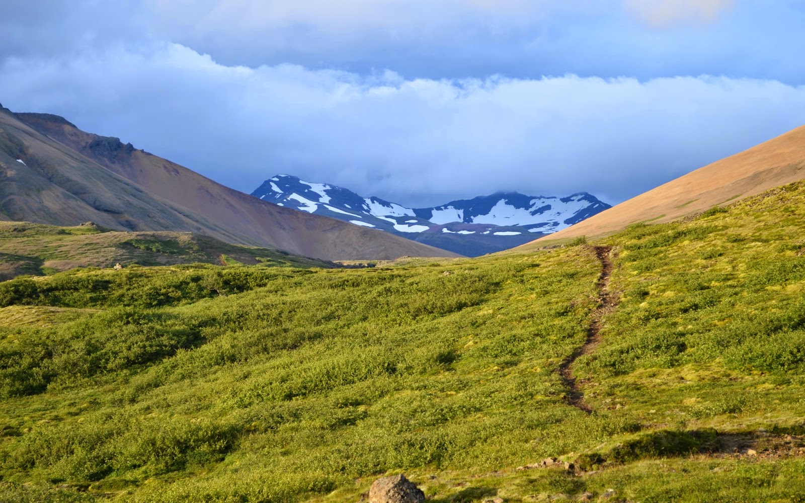
It's not a difficult trail hiking up into the hills first toward Gildrufjall, not steep but rolling.  I'm hiking in a well-worn trail even if the grass and shrub were thick and sometimes hid the trail.  It was warm, full of sun, beautiful meadows.  The most wonderful part of this hike however, is that I'm walking directly north northwest and directly into the setting sun.  I spend a lot of time on the trail considering how amazing this experience is, walking into the sun setting into the north.  Also, the simple experience of walking into the sun at all.

By the time I'd reacht the summit of Gildrufjall, I had a great view of the mountains to the east, a white pink red rhyolite of extinct volcanoes, these massive naked stone edifices slowly eroding into these beautiful ranges.  Through the Hafradalur valley, snow on Fláatindur in the distance.


East into Hafradalur
Now, I'd come across a number of other well-worn trails and though I knew my direction, the one trail to take wasn't as clear to me now.  As I came down Gildrufjall, I took one well-worn trail that vanisht into nothingness.  Hmmm.  Not this way.  So I backtrack to where I took that turn and head down another path, only to find myself again in no man's land, the middle of a meadow.  Beautiful lush grass and shrubs and the warm sun.  It was all a great view wherever I stood.  But the proper path was now unknown to me.  Let's make this more heart thumping.  I had no idea now which path back was.  I thought, ok, twice I've been trickt by whomever.  Now's the time to head back.  Eh, head back what trail?  When I backtrack there isn't a trail to backtrack.  So I see a trail (one of many) that seems reasonable (whatever that means).  I'm now somewhat concerned about where I am, but I think, just be reasonable (whatever that means).  This path seems reasonable, generally in the direction I want to go.  Which I can see will turn out to be a sheep's path narrower and narrower and then into nothing along side this mountain slope.  With a beautiful view. 


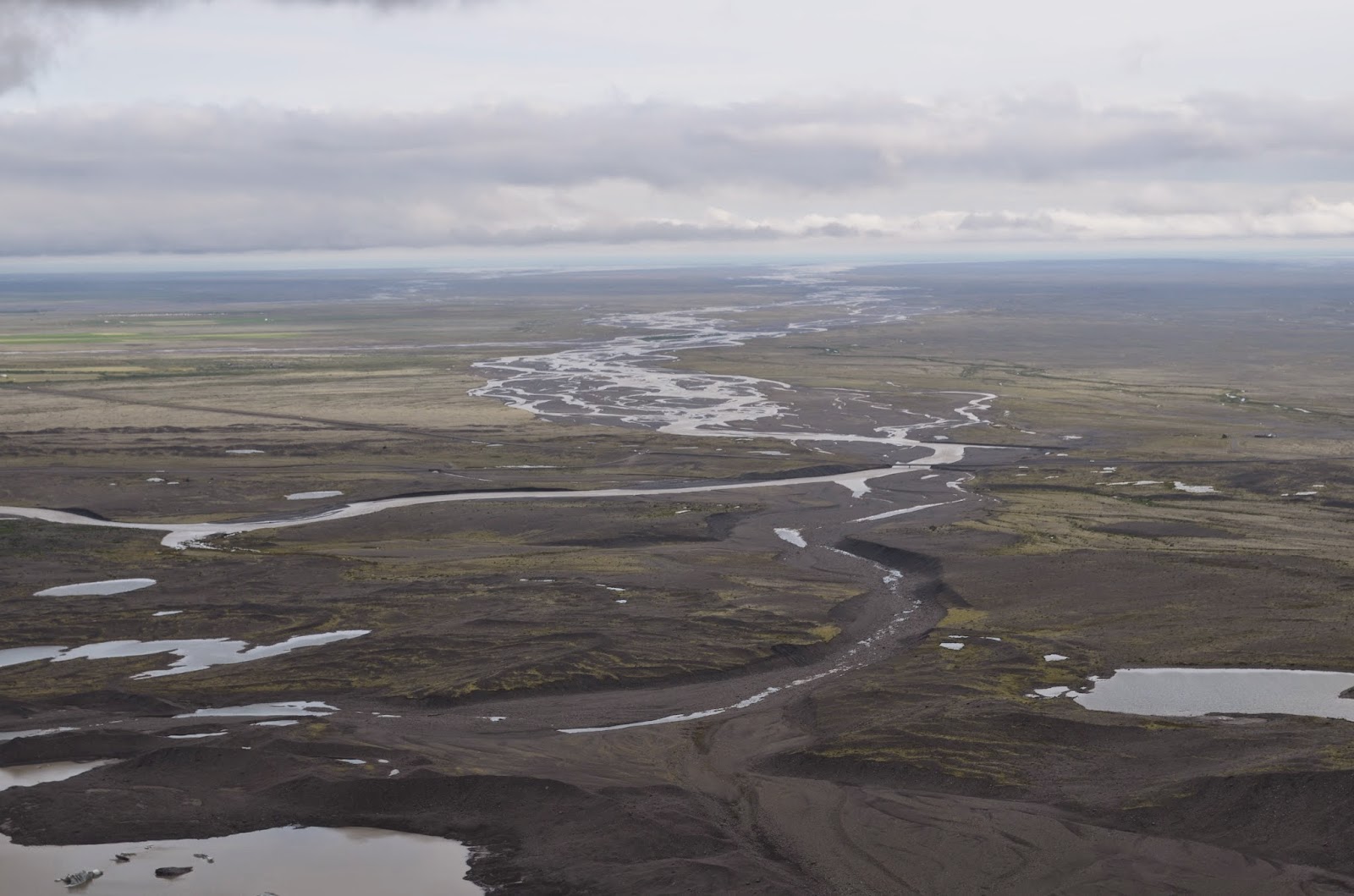
Jökulsáraurar, looking north northwest

Firstly, you don't fall into some panic on my behalf, I'm not drawing you into some adventure story that goes bad. Let me do the panic thing. Which I don't. There's still plenty of sunlight left. I'm in a broad meadow rolling down from Gildrufjall, I can see the wide Jökulsá plain before me and its widely wild meandering. I can see that plain several hundred thousand meters down the mountainside I'm on. I can see that the slope of the mountainside becomes impossibly steep to climb down, it seems more vertical than sloping really. There's a gravel road down there! Roofs that I assume houses are underneath! The chance of a lifetime, to climb down this impossibly high and steeply sloped mountainside with only sheep's tracks on it. 

I have an orange pullover and a mobile phone will a full signal.  But I am determined not to be the victim of a Search and Rescue mission.  (Which frankly is far too common.)  Benjamin.  Let's just turn back.  You've plenty of sunlight left....

Where's the bloody trail back?  Well, twice trickt I'm not going any further north northwest, and since the direction I came from is the direction I want to go, I'm not fusst anymore about there not being a proper trail. I have excellent boots on.  There's a straightforward path in my mind, back to the start of this hike.  Due south southeast. As the crow flies.  I cross a number of well-worn paths, but I'm not stupid.  I've not taken them before.  Or I have...  (Are your hearts thumping? Mine was laughing.)

Only when I come across an old gravel road do I realize, well, this is ok to follow. It meanders along the mountainside in the general south direction it needed to if it wanted my company. It's a road to an electrical station of sorts or a broadcasting station of sorts, and then the road plunges down into a valley. That's good. And the road has obviously had recent company. That's good. I look across the stream cascading down in the valley, I've walkt along side you already, haven't I? On the other side of you is the path I want to take directly back to the guesthouse, right? Can I jump over you please? and keep my boots dry at the same time? Takk.


Jökulsár í Lóni, south the sea in the far distance.
The stream and path home in the near
Down the path, and I'm back and I visit the guesthouse to let the man there know I'm back.  Always a important courtesy to first inform someone where you're going and inform that same someone that you're back.  I laught and said that after I'd been trickt twice on the trail, I decided to turn back.  „It wasn't me!  I didn't trick you!“ he cried.  „No! no! you didn't! but someone else out there had their bit of fun....

I will find my way to Vötn someday, the lake at the far northwest end of this trail, the destination I truly intended.  With their help this time, not their tricks!

---

I drive back into Höfn and it's just past 22:00 and past just closing at The Pakkhús, but I ask if I couldn't just have the lobster soup and another beer.  There were still enough people in the restaurant, and the menu request was easy so they did accommodate that.  Same table next to the window with the same view of the Sigurður Ólafsson tied fast to the docks.  I brought up the question about the brennivín schnapps that is this special Icelandic drink for special occasions, and askt if it was something I should try.  Actually I askt if they liked it, and I didn't get but these pulled down faces trying very hard not to show their distaste.  Ok, so it's vile then.  Let's get it over with.  She brings me a shot glass, pours one, says skál, my shot glass and her bottle of brennivín clink, and I down this clear liquid which turns out to be very complicated and with a nice finish of rye bread.  Ahh!  How vile you are.  Their faces didn't lie.


From Höfn, view northeast to Fláajökull


Monday, 28 July 2014

Trausti og Fagrifoss

Trausti og Fagrifoss


The visit to the Lakagígar, or Laki lava fieldswas simply miserable.  I don't mind rain and gray and wet socks, but it was a gale and I hate drafts.  Trausti, our guide, his name means loyal and trust, told us as we started, that he had one thing to show us at the end of the day, which he said was the most beautiful waterfall in all of Iceland. 


And at that he certainly kept to his word.  Fagrifoss  ('fah gri foss, roll the r) means "Beautiful Falls".  I've since browsed the web for other photographs and videos and frankly, none are as dramatic as these that I was able capture, this all due to the amount of rain south Iceland had been inundated with this summer, the wettest in 50 years.  This day was seriously miserable weather (thanks Guðmann) but this made Fagrifoss all the more beautiful (thanks Trausti).


Fagrifoss, in the Lakagígar
Having a lot of fun learning video editing!


Earlier, we visited a lava cave⁄tunnel, which I have no pictures of and no idea where in Laki park it is, but the family with a 10 year old also on the tour with me were keen as I to explore it.  As I'd visited the lava cave near Húsafell, I was able to give them quite a nice geologic explanation of what we saw, how they form, why the smooth walls, the lava stalactites, and blobs on the floor of the cave, and always especially fascinating the curled up chocolate shaving of lava along the sides of the tunnel.  We didn't have helmets nor torches, but did have iPhone flashlights, but we didn't linger as it was a bit claustrophobic.  The boy was able to get pretty much further along to where he could stand up, so I had to do the same and trust I'd not split my head open on the rough roof.  It was there that a whole lot more proper examples of what to find in a lava cave could be found.


Sunday, 27 July 2014

Skeiðarásandur og Skaftafelljökull


Skeiðarásandur 
bridges

I found that Skeiðarásandur bridges, one-land wooden ones with a metal mess bed, would "sing" as you drove over.  I'd speed up or slow down as I drove across, to get the car in tune with the bass of whatever was on the stereo.  Here, driving east, with Vatnajökull directly ahead, Skaftafelljökull to the left.
---

Skaftafelljökull
It really did just lay there, melting.  I hiked up to Sjónarnípa point and scrambled down the point as far as possible where one more step would put me on the glacier after a very very long slide down.  Testing my fear of heights I suppose.  After that let-down, I hiked up further up on the trail towards Gláma point, and halfway there, I stoppt to take these photographs of Skaftafellsjökull, which, as I said, just lay there.


It firstly just appears from under a cloud. I could explain the striped bands in the ice if you'd like.  From this height, the creaking and cracking and crushing of the glacier's imperceptible movement downward was inaudible or a myth.
Here it is right in front of me!


It continues on a bit further and just gives up. By this time, the glacier ice is filthy with all the gravel and sand and ash it has accumulated over time. Melting into a small muddy lake, dammed by a moraine dotted with kettle lakes, and slowly draining and moving on through the vast Skeiðarásandur plain southward to the sea.


The trail map is pretty good actually, and shows both the Skaftafellsjökull and Svínafellsjökull, the latter I'd be ice hiking and climbing on in a few days.